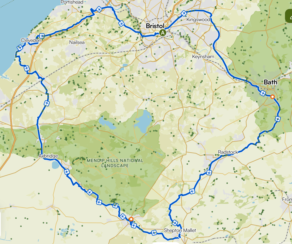
The aptly named Somerset Circle is an 88-mile, mostly traffic-free circuit linking Bristol, Bath, the Mendip Hills, the Somerset Levels and the coast. Over two-thirds (about 50 miles) of this potential route has already been completed and includes the Strawberry Line, Colliers Way, the Two Tunnels Greenway, the Bristol & Bath Railway Path, and the River Avon Trail.
The map on this page is the Komoot version for cyclists, which you can use on your smartphone to navigate the route. From 2026, the Komoot’s basic version is not free, so if that doesn’t work for you and you wish to use your own navigation app, you can download the GPX file below.
The smartphone app, Beeline, is free and displays the route well, with several navigation options. Be sure, when importing the GPX to this app, to select the Breadcrumb option, or else it may reroute your journey onto roads.
Bristol Temple Meads train station is shown as the start and end point, but you can start at any point on the route.
A Komoot map for hikers is under development.
Komoot Cyclist’s Navigation Map
Click on the image to open the cyclists’ map in Komoot to view and navigate the route.